The island of Tenerife with its over 10,000 feet volcano provides a great diversity in the Walking / Hiking routes available. From the sometimes Snow covered Mount Teide, the warm lovely south coast, the rugged and wild north east coast to the climatic Pine forests allow hundreds of kilometres of paths and trails in these environments to be experienced. To walk many of these inland paths and trails, a car is essential, but many of the excellent coastal walks near your resort may be reached from your accommodation without a car or perhaps just a bus.
Latest Walks
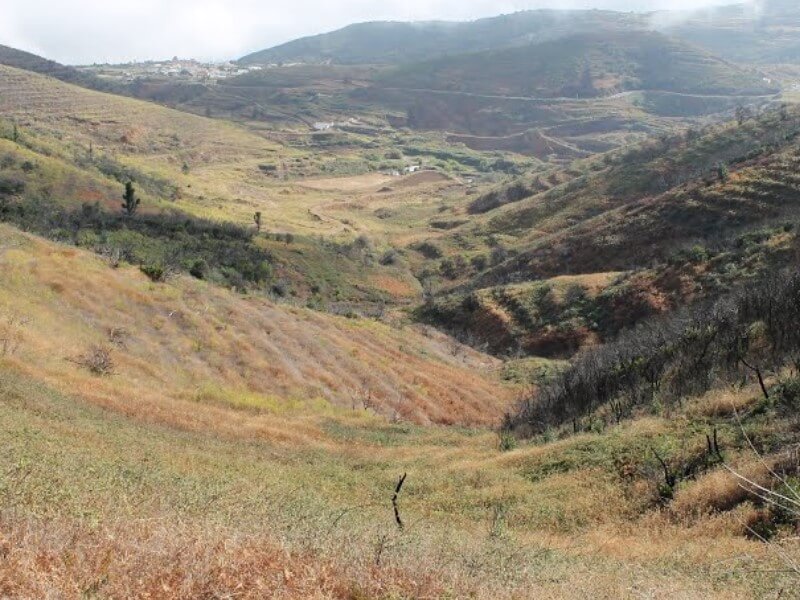
Las Vegas Circular walk
An interesting and varied walk starting from the nice village of Las Vegas, crosses an open canal with running water, some rock houses and an old watermill.
A distance of approx 8.5km / 5.2 miles, total accent / decent is 350m/1150ft, time 3.5hours+
An interesting and varied walk starting from the nice village of La Quinta, easy trail to Boca de Paso with wonderful views then on to Barranco del Infierno with views of the "Calderón".
A circular route with a shorter option to return - a distance of approx 6 miles for longer route and 4.43 miles for the shorter route.
A circular walk in a beautiful area with historical features and many plants.
A distance of approx 7.8km / 4.88 miles. Total ascent: 407m / 1336ft, Total descent: 400m / 1330ft
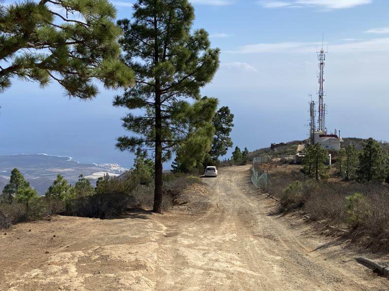
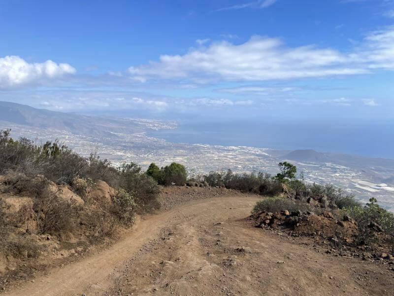
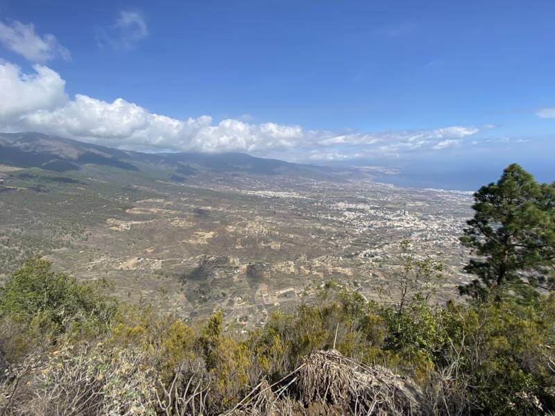
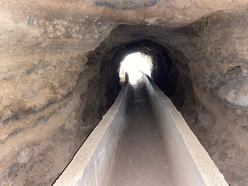
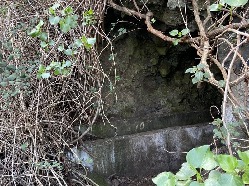
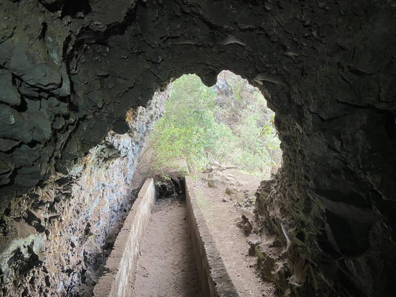
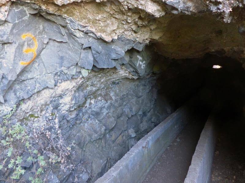
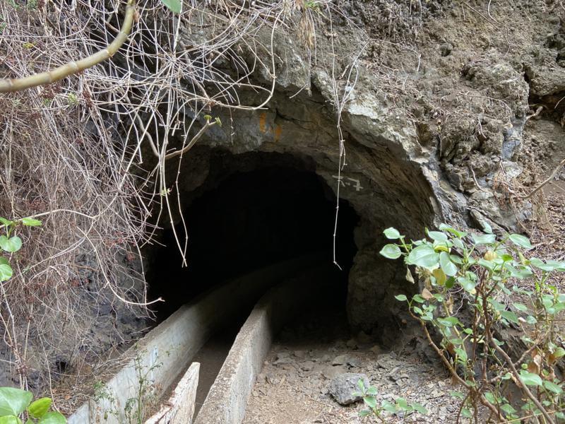
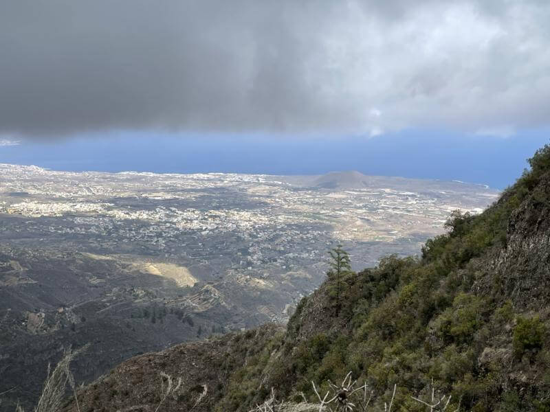
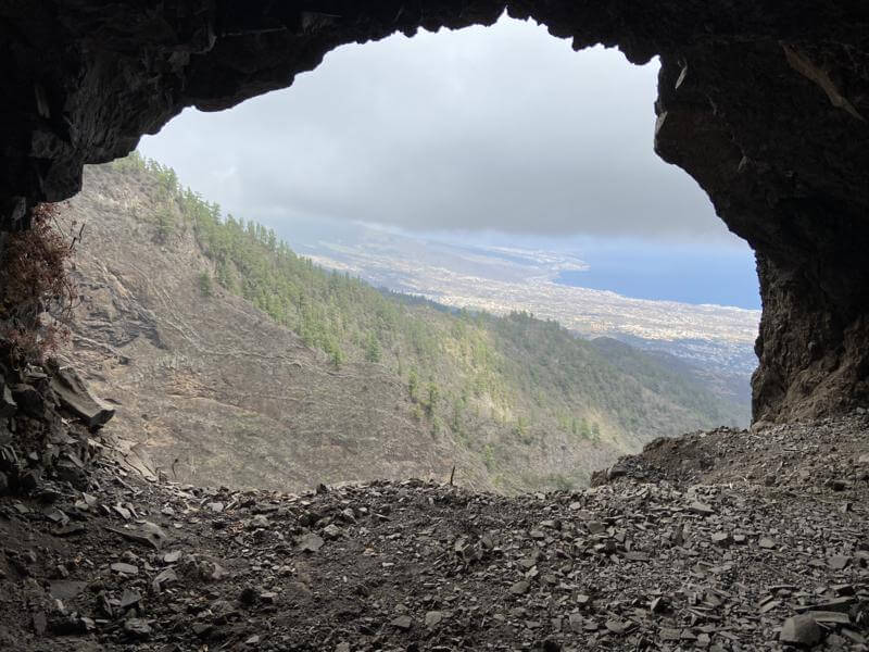
Approach from the east - from Camino las Coloradas with option for detour to Galeria "La Paloma.
A return distance of approx 9.4km/5.84 miles, total ascent / decent: 287m/942ft or 11km/6.84 miles and total ascent / decent: 616m/2021ft including Galeria "La Paloma".
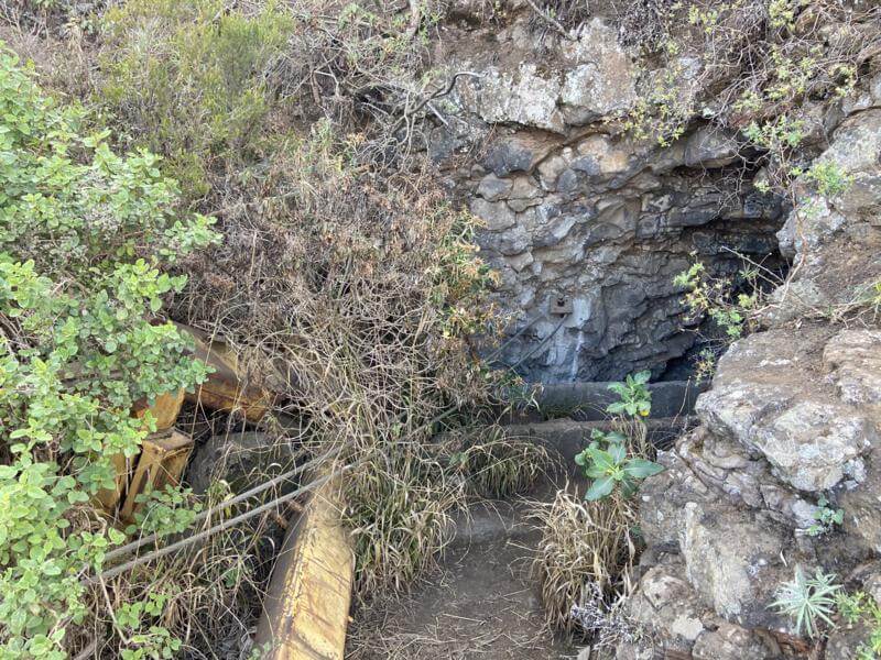
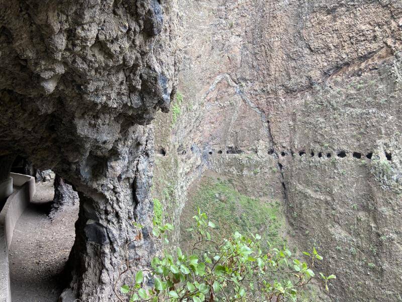
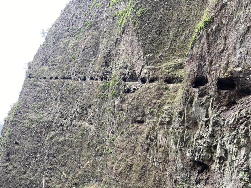
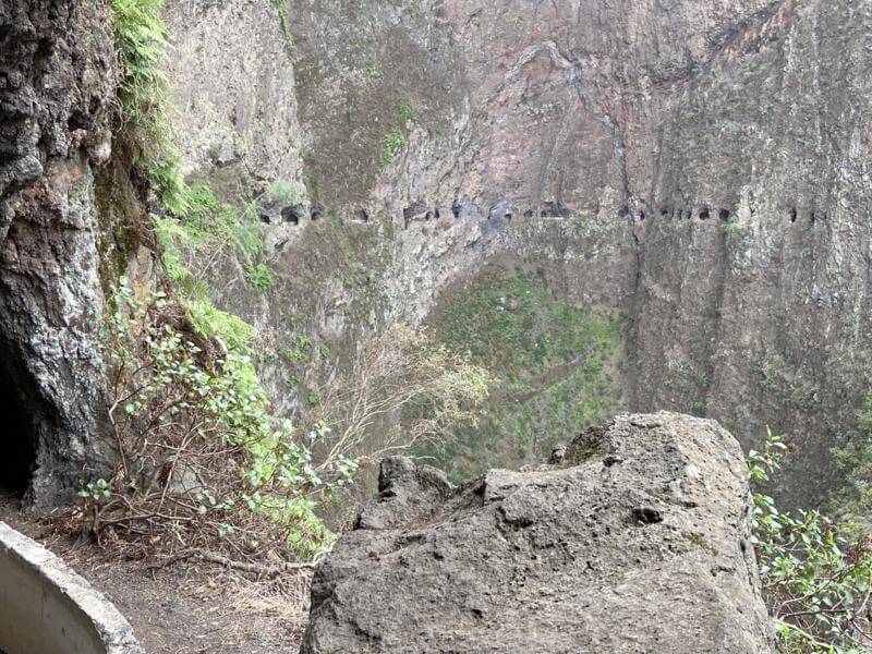
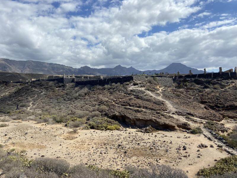
A remarkable place – one of the world wonders created by the Canarian men.
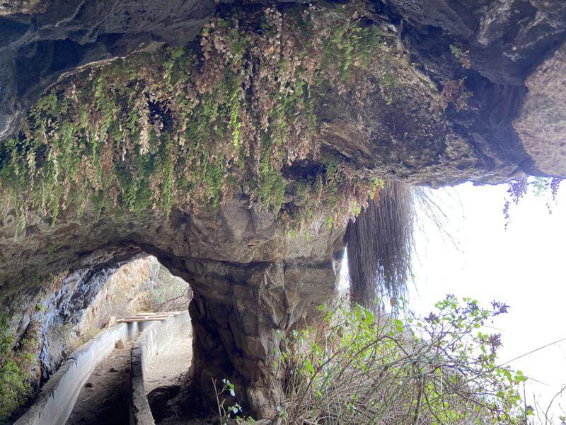
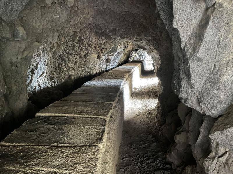
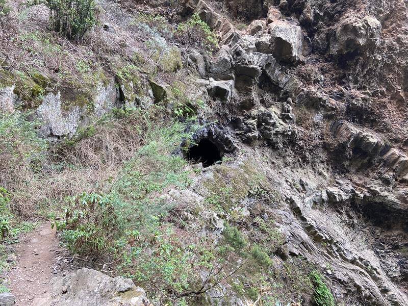
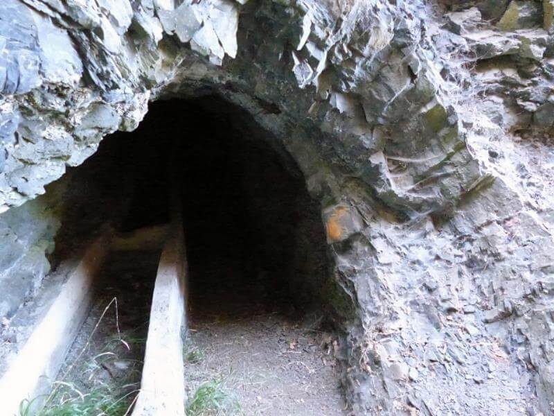
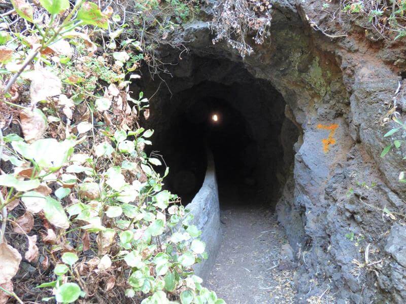
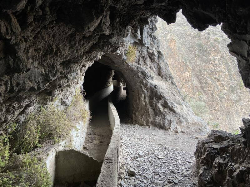
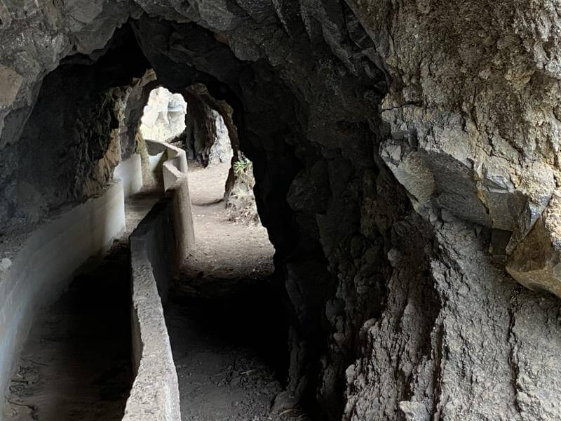
A canal built around and through mountain ravines at a height of 1000 metres above sea level to carry water from high in the mountains.
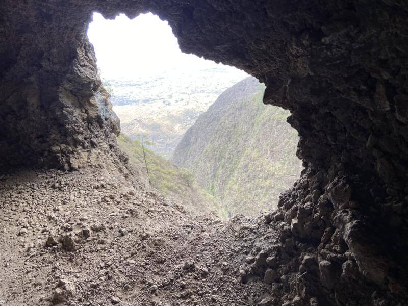
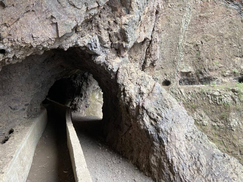
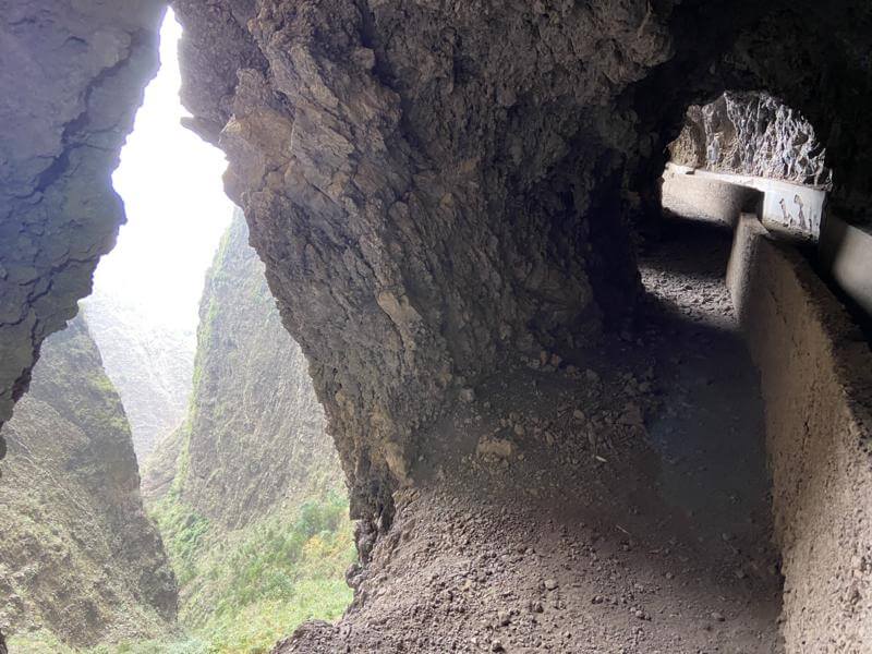
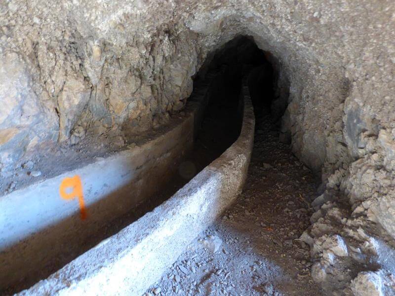
Through the mountain and along the ravines up to 10 tunnels were excavated to carry the canal.
Along the canal, the windows of the Güímar gallery were made to allow light to enter the tunnels and to throw away the remains of rocks and earth resulting from the excavation.
It is very odd that this water channel never came into operation, given how hard it must have been to build with pick and shovel.
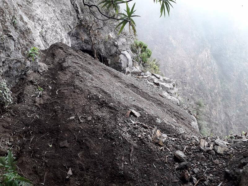
I wouldn’t recommend this trail to people who suffer from claustrophobia or extreme fear of heights. Also, keep in mind that this is not an official trail and is not maintained. To put it simply, if you do this hike, you do it at your own risk and you are probably breaking Canarian law.
If you are thinking of doing this walk then check out many of the websites that describe this trail.
Note: Headtorches are essential.
Park HereWalk up hillPath to canalCanal ViewDiggerTunnel 1End of Tunnel 1Tunnel 2End of Tunnel 2Tunnel 3Between Tunnel 3 & 4Entrance to Tunnel 4View from Tunnel 4View in Tunnel 4Canal in Tunnel 4Canal in Tunnel 4Between Tunnel 4 & 5Entrance to Tunnel 5In T5, T6 aheadTrack to T6Tunnel 6Tunnel 7Tunnel 7 loop passageView from Tunnel 7Tunnel 7 with windowTunnel 8 aheadTowards Main GalleryFuga de Los Cuatro RealesView in tunnel along main galleryView out of Fuga de Los Cuatro RealesView back Fuga de Los Cuatro RealesView back along of TunnelView back along TunnelFinal view200m Tunnel 9500m Tunnel 10Way out via Tunnel 4
Short video of Ventanas de Guimar (Oct 2021):
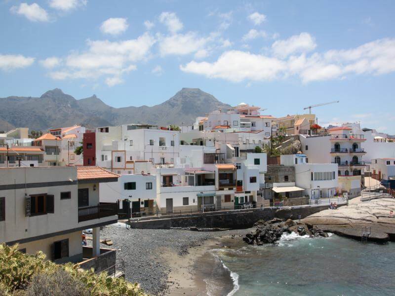
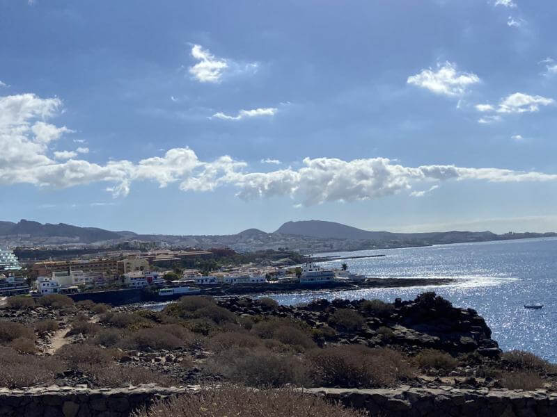
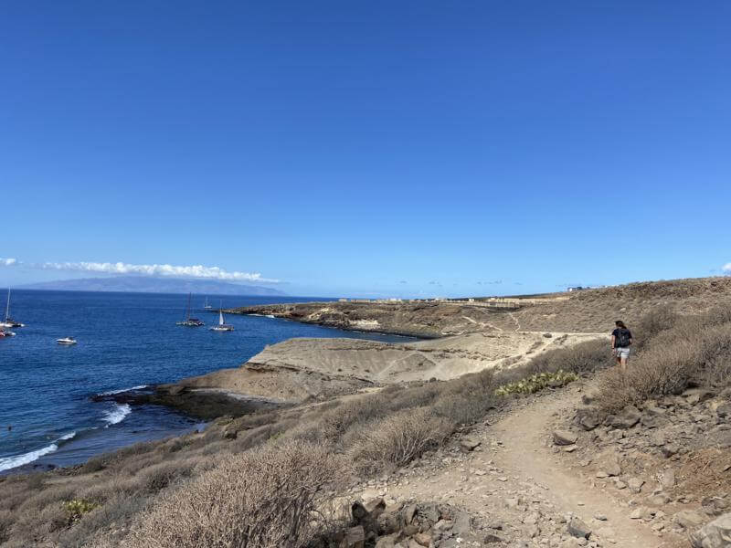
La Caleta towards Playa Paraiso
A very pleasant and easy walk with some nice scenery.
There are many options on this walk to extend or shorten your walk – like start further back along the coast – say Fanabe or complete the walk to Playa Paraiso and catch a bus back to Fanabe Plaza.
Our recommendation would be to walk to El Puertito and retrace your steps unless you want to catch busses.
The route:
Leave La Caleta and head towards Playa de los Morteros along the coastal track.
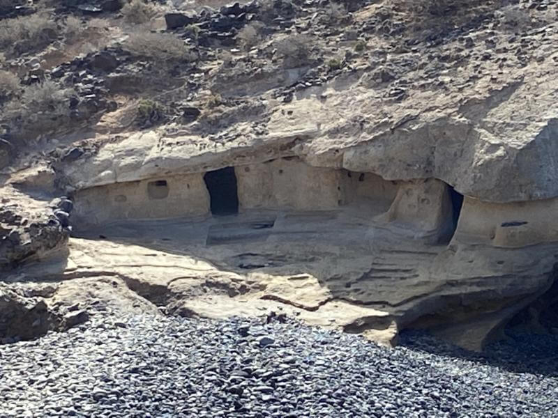
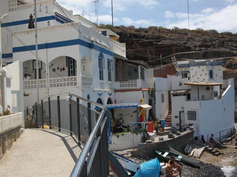
Playa de los Morteros has some old rock houses and an easy track that leads to the beautiful Playa Diego Hernandez. A track overlooking this Playa leads to the small Barranco del Burro de los Curbelo with a short climb up to a disused plantation. The track goes around the plantation and drops into another small barranco (Barranco el Medio) with a short climb leading to the track to El Puertito.
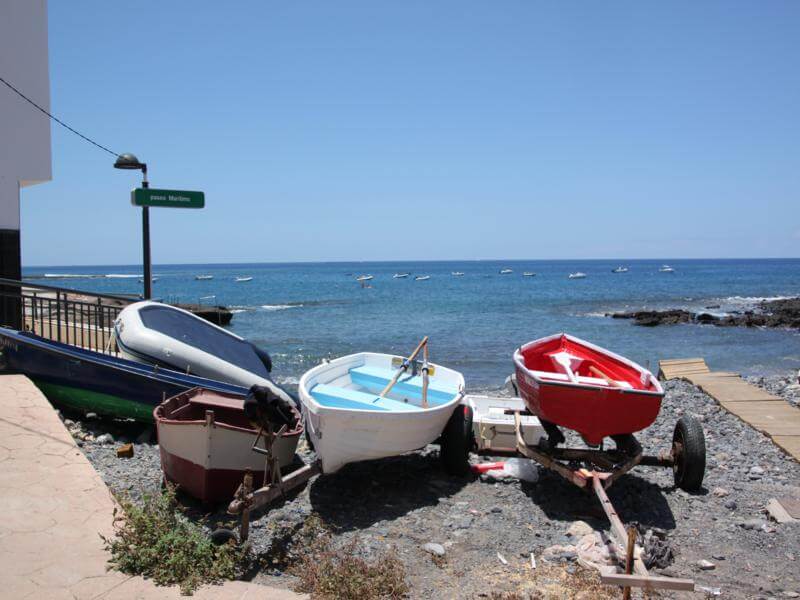
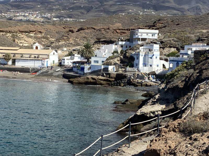
From the El Puertito peninsula there are lovely views of this fishing village and a path winds through the cottages to the boat ramp and beach. There is a nice Bar / Restaurant here for refreshment.
If you decide to go on, then the path leads across the sea wall and up to the road.
Immediately on reaching the road a track leads off towards and through the shanty town and eventually reaches the Bahia Principe complex. Here a coastal path around this complex leads to Barranco de las Salinas. A path down leads across with steps up to Av Adeje 300. You are now on the outskirts of Playa Paraiso. There is a bus stop on this road – catch the bus to Fanabe Plaza.
Photo Album Trip: Oct 2021
Route in blueLa CaletaLa Caleta BoatsLa CaletaPlaya de los MorterosPlaya de los MorterosRock DwellingsTrack backPlaya Diego HernandezTrack backTrack forwardOld plantationView backView: El PuertitoRock House El PuertitoPlaya El PuertitoPlaya El PuertitoPlaya El PuertitoBarranco de las Salinas
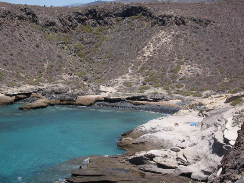
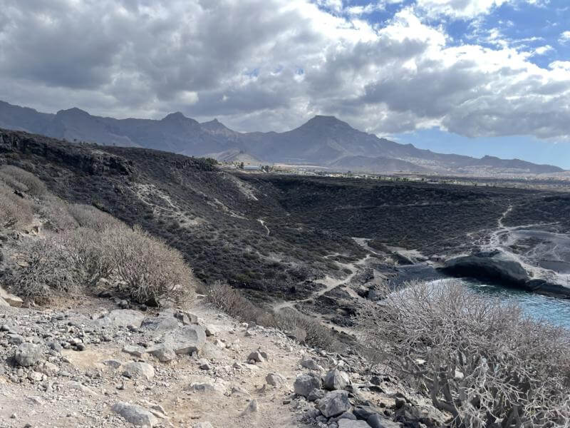
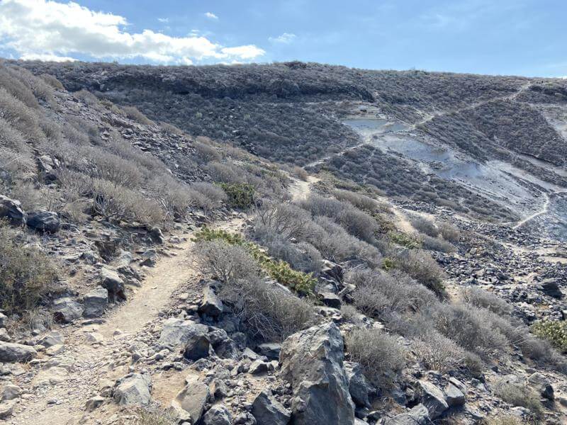
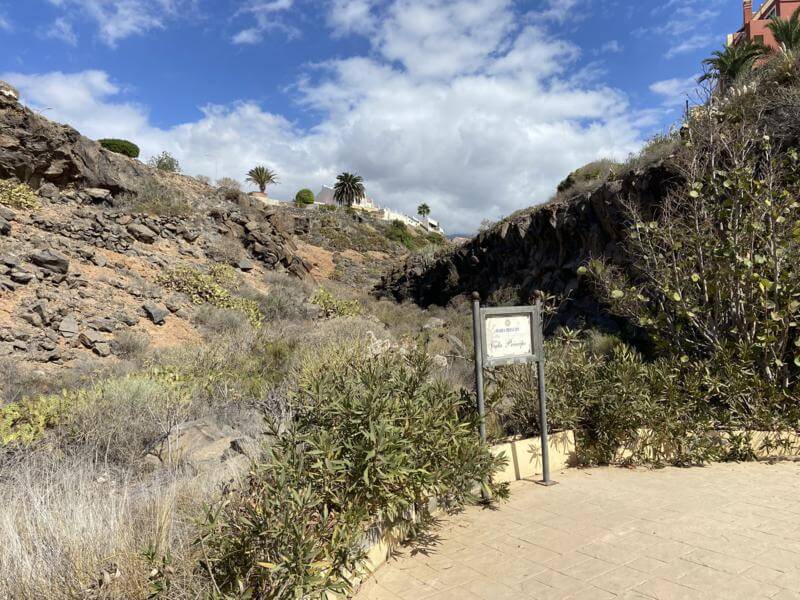
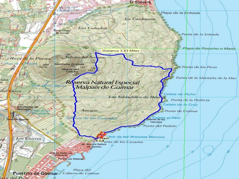
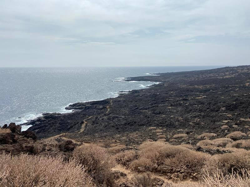
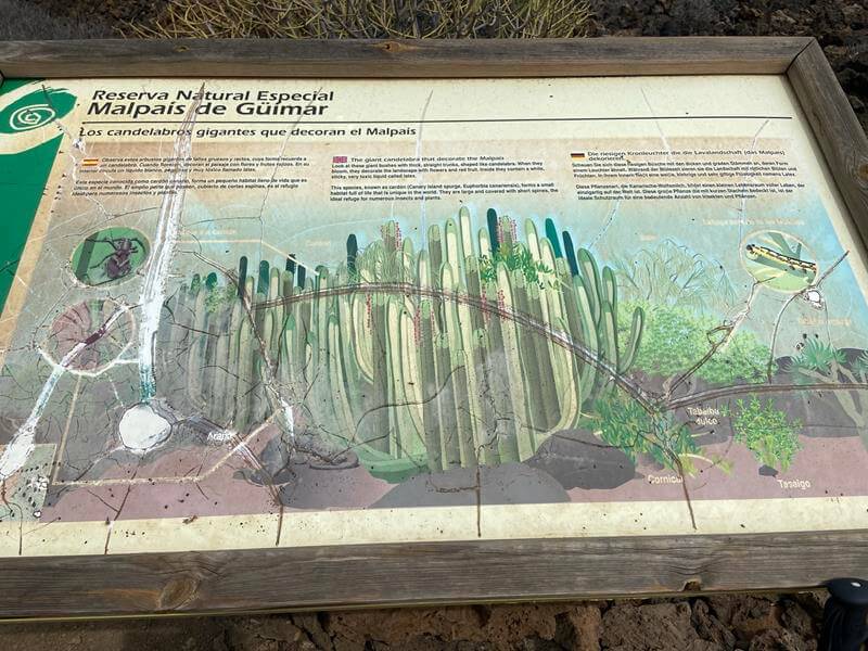
Malpais de Güimar
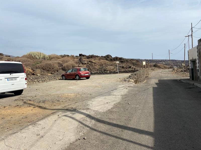
Head towards Puertito de Guimar and then take left turns to reach the end of Calle Marques de Santa Cruz where there is a car park, failing that just park in the town and head north along the coast.
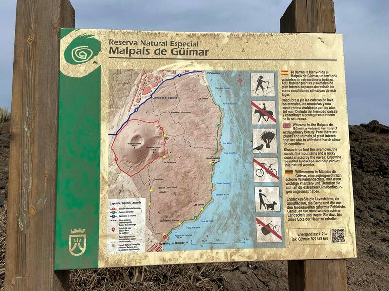
An easy walk through “The Malpaís de Güímar Special Nature Reserve” ( a natural area located in the southeast of Tenerife), a distance of about 3.8 Miles as shown in blue on the route map.
This route can be extended with tracks to El Socorro and around Montana Grande.
A very rugged area which contains much plant life and would be best seen in the spring and perhaps very early summer after some winter rains.
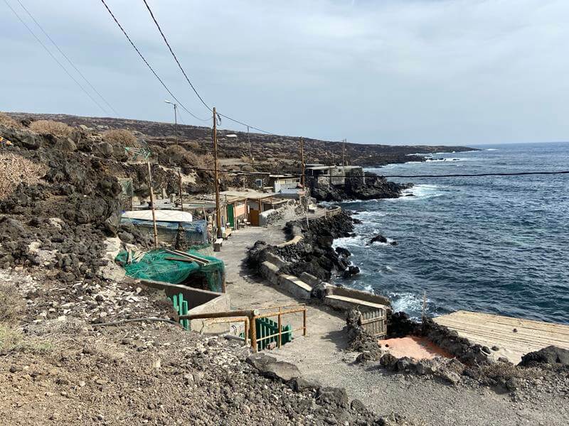
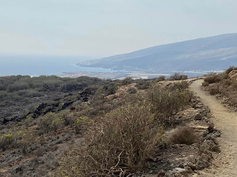
A circular route is shown following the coast northwards, passing some shanty houses and eventually reaching a climb over Montaña de la Mar offering good views of some of the reserve and coast.
After a walk down and across and another up slope a junction is reached with a finger post.
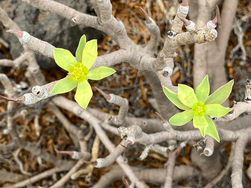
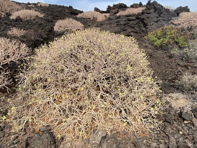
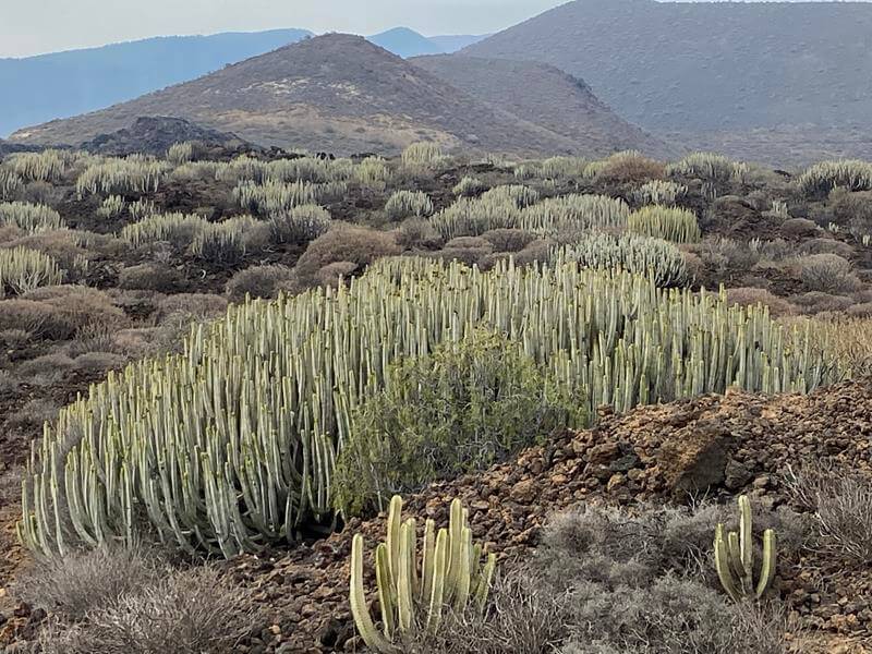
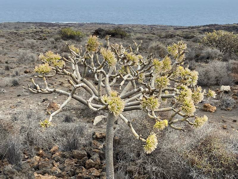
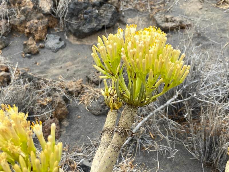
Here one can continue along the coast to El Socorro, but the route shown takes a left here and heads towards Montana Grande. There are many plant species on the way including Balsam Spurge (Euphorbia balsamifera), Canary Islands Candle-Plant (Kleinia neriifolia) and of course the Cardon (Canary Island Spurge – Euphorbia canariensis).
Towards the base of Monta Grande a T junction is reached and a left turn here heads back towards Puertito de Guimar passing Mirador de las Morras del Corcho with nice views over the reserve.
From here the track leads to another junction and keeping left here brings you back to the car park after passing another Information Board.
Photo Album Trip: Nov 2021
Route in blueCar ParkInformation BoardShanty housesView BackBalsam SpurgeBalsam SpurgeMontaña de la MarMontaña GrandeCardonCandle Plant bushCandle Plant headRoute backInformation Board
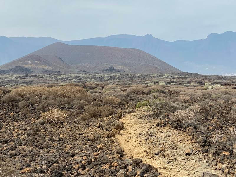
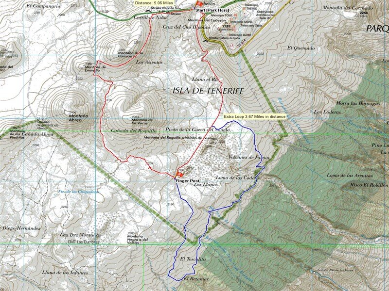
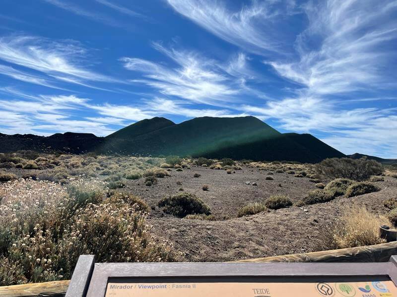
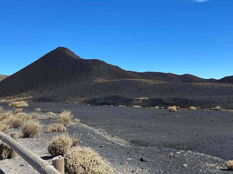
Volcán de Fasnia
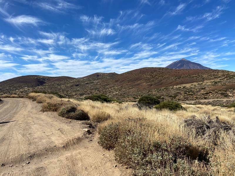
An interesting walk to the black light absorbing Volcán de Fasnia on the Mount Teide Caldera.
From the west ( Mt Teide) drive along the TF-21 towards the Teide Observatory (Observatorio Astronómico del Teide) and park in a layby on the left just before the right turn to the Observatory.
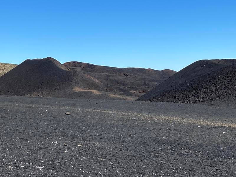
The walk starts here and is circular around Montana de las Vacas for a distance of 5 miles and is easy going with good tracks.
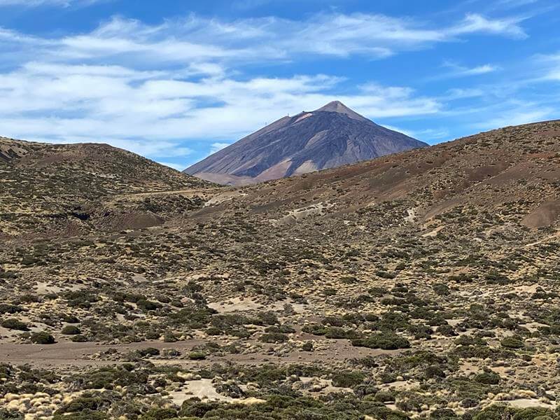
The track starts on the road for about 100 metres and at the junction with the Observatory road a track to your right here leads down towards the volcano. There are some nice views of Mt Teide as the very black Volcán de Fasnia approaches.
There is an option before reaching the volcano to take a longer route (shown in blue on the route map), this adds and extra 3.67 miles to the walk.
A Viewpoint is reached with a good information board.
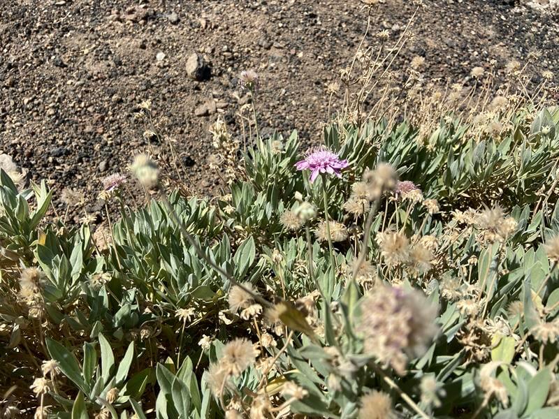
Some plants were observed on the way like the Pincushion Flower (Pterocephalus lasiospermus) but I suggest a spring visit would be best for flora.
Further along a finger post is reached and here we take a right turn uphill towards Mirador del Corral del Niño - our return route.
The track follows around Montana de las Vacas with some interesting rock / lava views and a
Common Kestrel, ssp. Canariensis was also spotted on a few occasions.
The Track then reaches the road (TF-21) but a track on the right leads back to the layby avoiding walking on the road.
Photo Album Trip: Oct 2021
RouteTrack near startView of TeideVolcán de FasniaInformation BoardVolcán de FasniaVolcán de Fasnia TrackPincushion FlowerVolcán de FasniaVolcán de FasniaFinger Post - Right turnReturn Track-uphillVolcán de Fasnia
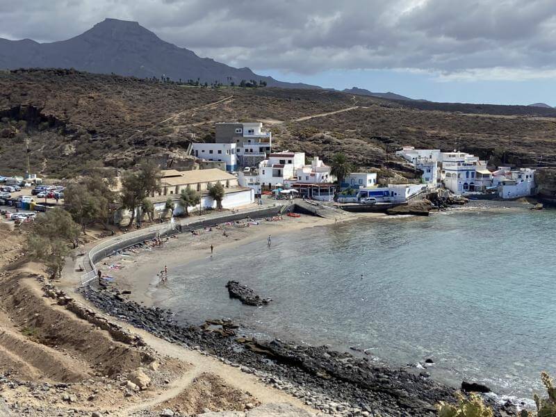
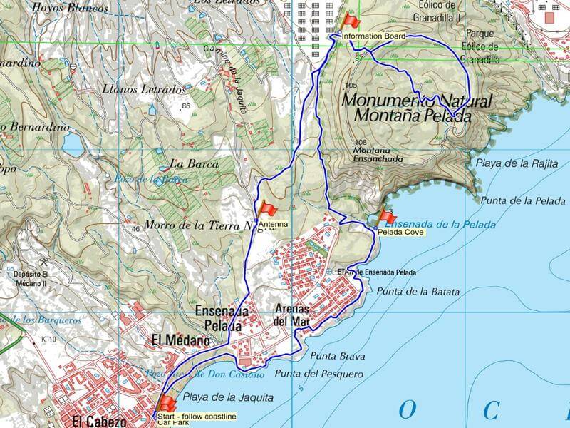
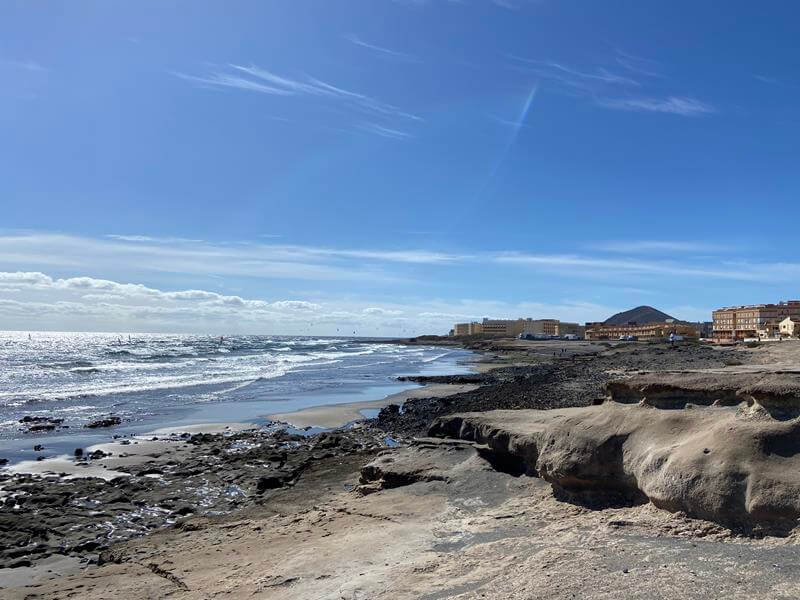
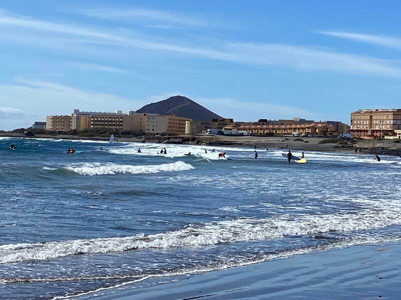
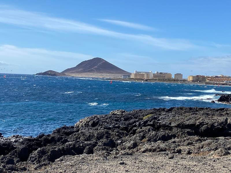
El Médano to Montaña Pelada
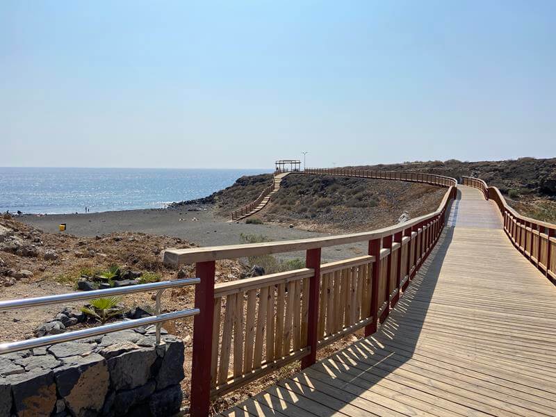
An unusual and somewhat interesting walk with some different views. This circular walk is around 5.61 miles (9 km) long and starts at the Coast Car park – east side of El Médano and follows the coastline northwards crossing Playa de la Jaquita – busy with wind sports. A coastal path can be followed around Arenas Del Mar and the villas and soon joins the track (Av Europa) slightly inland before crossing a small barranco to re-join the coast just before the front-line apartment block.
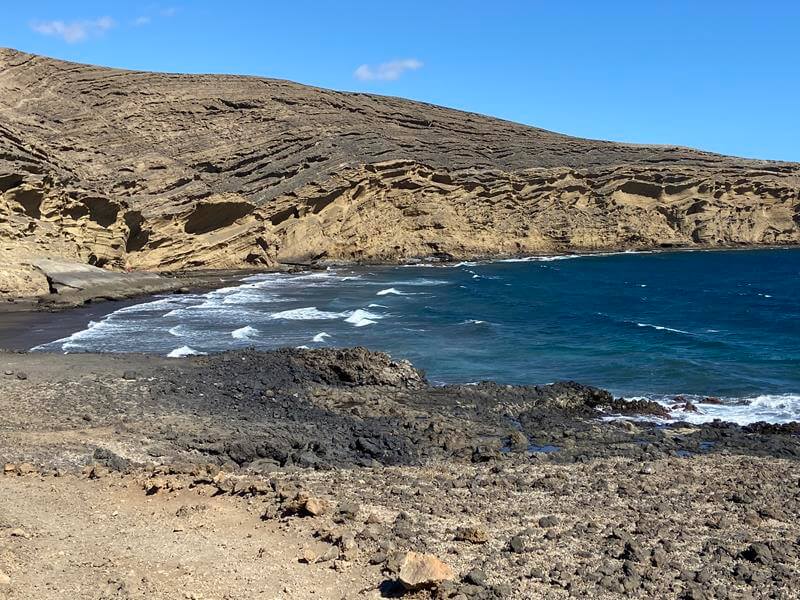
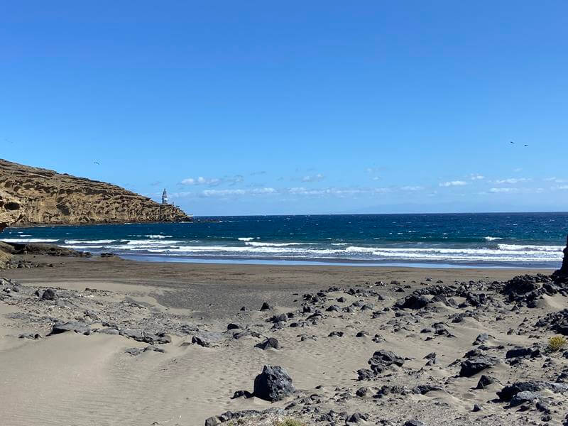
The Path continues around the apartments and then heads off up the coast before reaching the very nice Playa Montaña Pelada or Ensenada del la Pelada (Pelada Cove).
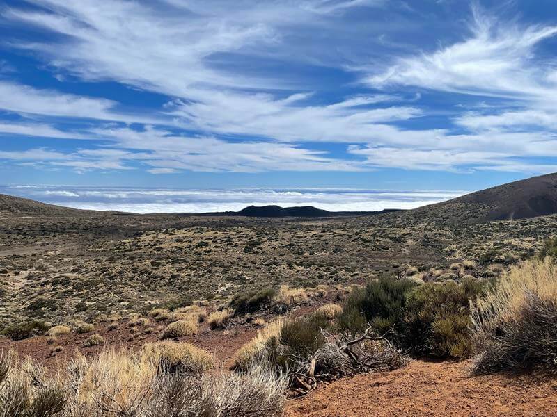
Here we take a track leading away from the sea crossing Barranquillo de la Gambuesa and eventually reaches a dry stream bed skirting around Montaña Pelada (Barranquillo de pelado). This terrain has many interesting features and is bordered by a protected natural area.
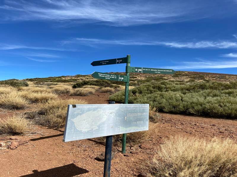
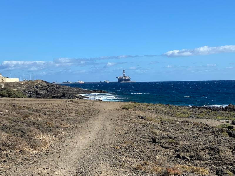
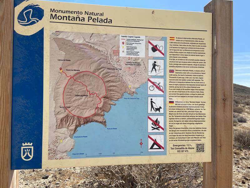
Eventually the stream bed joins a track at the Solar farm, this is followed upstream to a right turn to the Montaña Pelada information board. Here the track continues uphill to the rim of the crater where a walking track follows the circumference of the crater with a track along the middle as well.
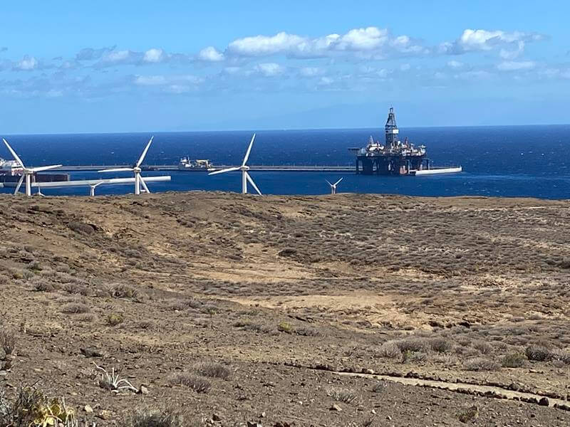
There are views of Puerto de Grandilla with its Oil Rig intended for off-shore but never used I believe and some of the energy park.
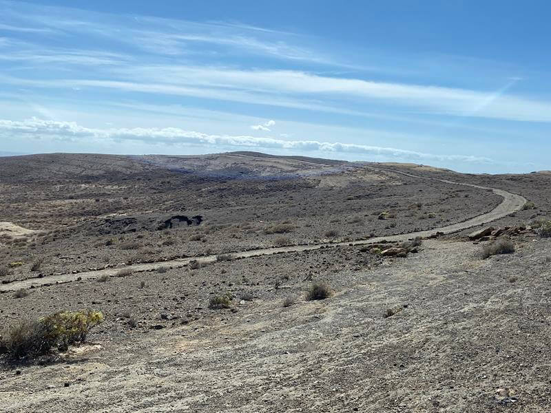
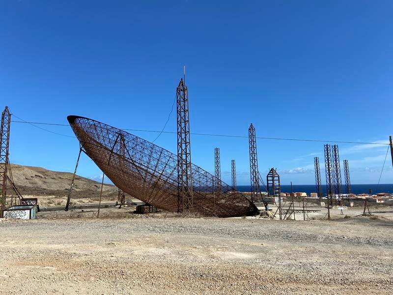
The return journey follows the same track to the end of the Solar Farm then keeps on the main track heading back towards El Médano until the crossing of a wider track. Here a left turn is made and soon an unusual very large Antenna is reached called the “Paella Pan”.
This was abandoned after local residents objected to the construction of thermoelectric solar power plant.
Soon the track reaches the main road to El Medano and a right turn leads back to the car park.
Photo Album Trip: Nov 2021
Route MapPlaya de la JaquitaPlaya de la JaquitaOil RigMontana RojaPelada CovePlaya PeladaDry Bed CardonInformation.Puerto de Grandilla Montaña PeladaAntenna
Coastal Walks
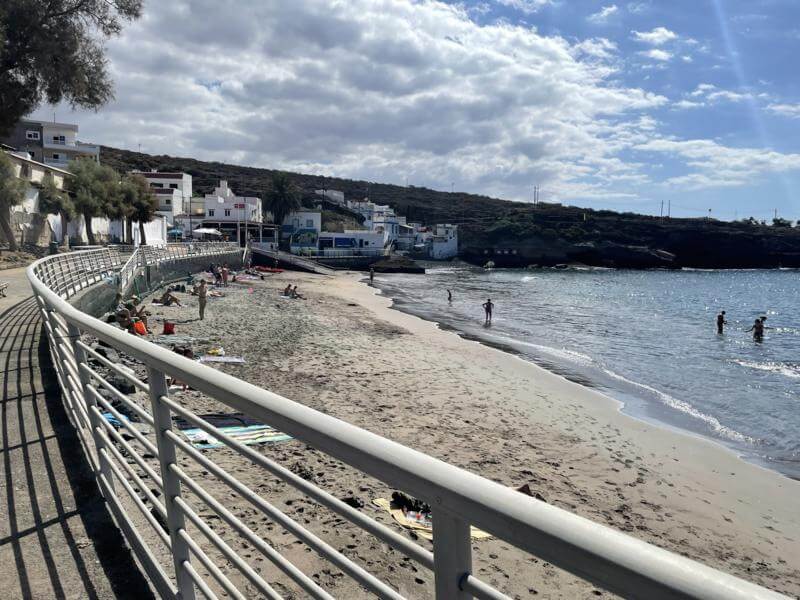
Los Cristianos to La Caleta (Geranium Walk)
Los Cristianos PromPlaya Las VistasLas Americas walkView of Playa FanabePlaya de La EnramadaLa Caleta
The promenade extends for around ten kilometres, from Los Cristianos. Passing Playa de las Américas, San Eugenio, Puerto Colón, Playa del Duque and ending in the fishing village la Caleta. There are plenty of bars and restaurants along the way for re-fueling and watching the world go by.
The route back can be done by taxi for around 6 to 10 Euros depending where the taxi is taken from or even better catch the Titsa bus from La Caleta to Los Cristianos. The bus number is 467 with Destination: Costa Del Silencio and runs every 20 minutes at a cost of around 1.50 Euros.
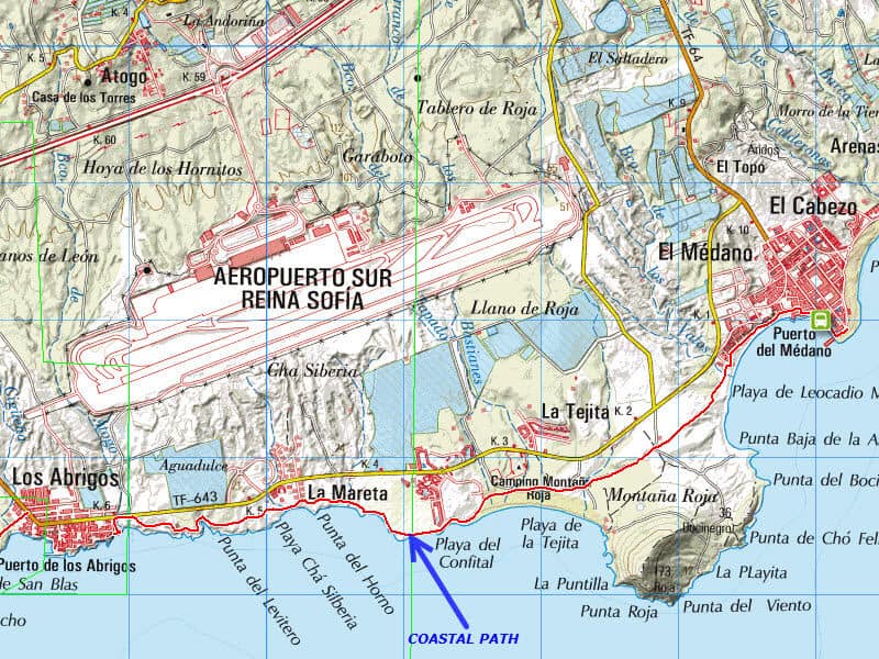
Coastal Path from Amarillo Golf to Los Abrigos
Map of WalkCoastal pathMarina San MiguelPath Playa GrandeLos Abrigos HarbourPlaya de La TejitaView of BocinegroEl MedanoMap to El Medano
From Amarillo Golf there is a constructed path that follows the beautiful rugged coast to Los Abrigos a distance of around 3.25 kilometres
The route can be extended via unpaved tracks to El Medano, a further 6.30 kilometres. ( Try to keep off the BUSY main road from Los Abrigos to El Medano) This route passes the Red Mountain - Montaña Roja and the long sandy beaches near El Medano. On return why not catch the Titsa Bus from El Medano and drop off at Pueblo Primavera (near Golf Del Sur) then a short walk down the hill to Marina San Miguel. The bus number is 470, with Destination: Los Cristianos and runs every hour on the half hour at a cost of around 1.45 Euros.
Other Walks
Masca Valley to the Coast
Masca Sea TaxiMap of TrailRoad to MascaNice Masca VillageBridge on Masca TrailMasca Trail in GorgeMasca ArchMasca JettyLeaving MascaLos Gigantes Harbour
The walk along the beautiful Masca Ravine starts from the hill village of Masca and follows down to the coast. The walk to the coast is around 2.5 Miles (4 km) and follows a unmarked track/s down the stream bed. Not difficult but be well prepared - Trekking/Walking poles useful, and boots giving ankle support advised. Due to the descent of around 2,400 feet to the coast, an option for this walk is to catch a taxi from Los Gigantes to Masca village ( to avoid driving the narrow hair raising road to Masca). Cost is around 23 to 27 euros. Walk the Ravine, and wait for a Water Taxi to take you back to Los Gigantes. You will need to pre-book the Water Taxi first thing before you leave Los Gigantes (Cost from 10 Euros). There are 3 taxis located at the marina - an early start is advised.
Masca Pick up - Water Taxi service with boats: Nashira Uno, GladiatorU and Punta Umbria The maritima acantilados have 3 boats all located on the marina in Los Gigantes. They have two offices the first is located on the marina / beach road near the barrier and is open from 08:30 to 19:00 the other is opposite the big supermarket in the center of Los Gigantes open from 09:30 till 13:00.
Maritima Acantilados Email and Website: Check out this link for one of the Water Taxi companies:
Masca Water Taxi
Please check out the Masca review on Trip Advisor to acertain the walk itself and your suitability.
Masca Valley Review
Please note: the Masca Gorge is now open again to tourists.
However a permit is required to visit the Masca Gorge. Until the new jetty is built there are no boat transfers so a strenuous return trip up the valley is required.
Recently re-opened, Barranco del Infierno is a nature reserve in the municipality of Adeje, in the island's southwest, whose more than 1,800 hectares (7 square miles) harbour one of Tenerife's most rugged natural landscapes. For just this reason, and for its quirks of topography, it has become a very popular hiking route. One of those quirks is the gorge which gives the reserve its name - a metres-deep cleft produced by millenia of water erosion. Other areas of the park worth visiting include the Rocks of Conde, of Imoque, and of Abinque. The vegetation here is another reason why this is one of the most beautiful spots on the island for nature-lovers.
Route AccessMap of WalkPine ForestGuajaraMontana ArenaRoute to Paisaje LunarOn routePaisaje LunarPaisaje LunarPaisaje LunarLower Paisaje LunarPaisaje Lunar
A lovely walk to Lunar-hoodoo like structures through a pine forest. A circular walk starting from the off-road track, not to steep, it is uphill nearly all the way to the structures and then downhill back to the start.
The climb is around 1,186 feet approx. a distance of around 4.13 Miles. Allow 3 to 5 hours depending on speed and fitness. Route is well waymarked. Location:
North of Villaflor, take unpaved track on the sharp bend (shown in blue), this is easily driveable and follow track for around 2 miles then find a place to park when you see the Waymarked posts.
Map of WalkP1-Erjos PoolsP2-Erjos PoolP3-View Ridge RoadP4-View Ridge RoadP5-Trail on RoadP6-Forest TrailP7-Ridge ViewInformationHeron - Erjos Pool
A lovely circular walk not too difficult passing the Erjos pools then up on to the ridge road before looping into the Laurel forests and finally a walk down from the ridge passing the pools
once again and back to the start at Restaurante Fleytas where some nice beer (or tea) and cakes at the bar can be consumed.
The Erjos pools have naturally formed in old quarry workings and provide a good habitat for birds and wildlife. Being situated in the Teno area to the west, low cloud and mist is very common,
so pick a nice clear day to appreciate the lovely views of the Teno area and Mt Teide from the ridge.
The climb is around 850 feet approx. a distance of around 3.75 Miles (6km). Allow 2 to 3 hours depending on speed and fitness.
Location:
North of Santiago del Teide, park near Restaurante Fleytas.
LocationMap of WalkP1-View of TeideP2-View of ChinyeroP3-Chinyero volcanoP4-Teide through PinesP5-West Lava FieldP6-Chinyero and Teide
The last volcano to erupt in tenerife was Chinyero in 1909. The lava flowed westwards and stopped overlooking Santiago del Teide.
This is a lovely circular walk around the volcano and crossing the lava field to the west.
Its around a 3 hour walk including lunch stop, a distance of just over 4 miles and a 1000 ft ascent and decent.
Location:
See location Map - Purple Star.
Situated on the TF38, park at side of road at CP1 or CP2 on map. If parking at CP2 you can take the dotted track to avoid main road.
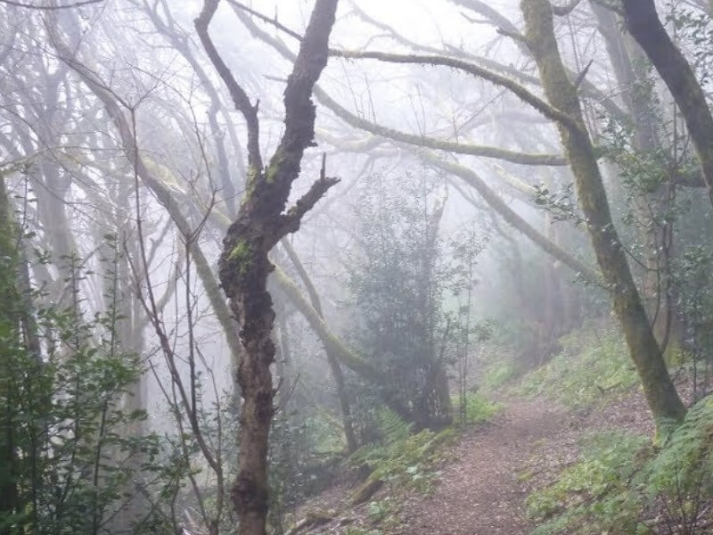
LocationMap of WalkLaurel ForestLos BatanesBoca del VientoCruz de CarmenRoque de TabornoLas Carboneras
Nice if energetic walk through the Anaga mountains (Rain/Mist Forest).
Its around a 4 - 5 hour walk including lunch stop, a distance of nearly 8 miles and a 3000 ft decent and ascent. Best on a sunny not misty day and at Chinamada it is well going to the Mirador - see blue dotted line on map. Nice Bar at Las Caboneras for well earned refreshment.
Location:
Situated on the TF12, park at Cruz de Carmen Car Park


.jpg)
.jpg)


.jpg)
.jpg)

.jpg)
.jpg)

.jpg)
.jpg)


.jpg)
.jpg)
.jpg)
.jpg)
.jpg)
.jpg)
.jpg)
.jpg)
.jpg)
.jpg)

.jpg)
.jpg)

.jpg)
.jpg)
.jpg)
.jpg)
.jpg)
.jpg)
.jpg)


.jpg)
.jpg)
.jpg)
.jpg)
.jpg)
.jpg)

.jpg)
.jpg)
.jpg)
.jpg)
.jpg)
.jpg)
.jpg)